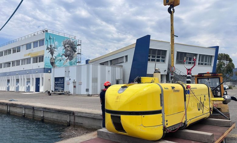
We have better maps of the Moon than of our own seabed, a fact oceanographers repeat because it remains true. Most of the deep ocean has never been seen, let alone charted. That is beginning to change as autonomous underwater vehicles — robot submarines that navigate, decide and survey without a pilot — take on the patient work of mapping the abyss, a mission followed by science and exploration coverage.
These vehicles are torpedo-shaped endurance machines. Dropped from a ship or a shore, they run pre-planned survey lines for days, pinging the seafloor with multibeam sonar, photographing the darkness in strobe-lit strips, and sampling water chemistry as they go. The newest fleets use AI to break the pattern: if sensors detect a hydrothermal vent or an unusual formation, the vehicle can decide to investigate rather than wait for instructions that, through kilometres of water, arrive slowly or not at all.
Why the Seabed Matters Now
The drivers are practical. Offshore wind and subsea cables need surveyed routes. Climate models need to know how deep currents move heat. Fisheries and conservation need habitat maps. And the contested question of deep-sea mining — for metals used in batteries — cannot be governed without baseline data on ecosystems almost nobody has studied. Programmes coordinated by agencies such as NOAA Ocean Exploration aim to map the world’s seabed in high resolution within the decade.
Costs are falling as the vehicles standardise: modular hulls, commercial sensors, and motherships that launch and recover several robots at once. Universities and startups now run missions that once required a research vessel’s full budget.
Exploration Becomes Infrastructure
The Map Is Only the Beginning
A mapped seabed changes what can be argued about. Fishing fleets, cable layers, conservation planners and mining companies all currently negotiate over territory they cannot see; charts convert opinions into evidence. Extended continental shelf claims — legal cases worth billions in potential resources — turn on bathymetry that autonomous fleets are now gathering. Marine protected areas, to be more than lines on paper, need the same surveys to know what they are protecting.
The vehicles keep getting stranger and better: gliders that sip energy and drift for months, swarms that split a survey between a dozen cheap hulls, and crawlers that inspect pipelines and cables on the bottom itself. Each new class trades capability against cost differently, and the ocean — patient, corrosive, indifferent — grades them all. What is emerging is less a fleet than an emerging utility: the deep ocean, instrumented.
The long game is permanent presence: docking stations on the seafloor where vehicles recharge and upload data, turning the deep ocean from a place we visit into a place we monitor. The abyss is the largest habitat on Earth. We are, finally, sending residents.